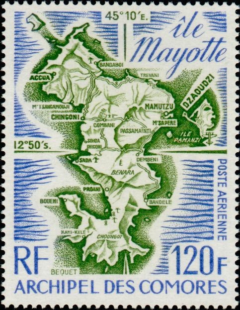
Map of Mayotte
Mayotte (Maore), geographically the oldest volcanic island in the Comoros Archipelago, is characterized by its complex coastline, rich coral lagoon, and distinctive dual-island geography comprising Grande-Terre and Petite-Terre (Île Pamanzi). Historically serving as the original administrative center of the French presence in the archipelago at Dzaoudzi, Mayotte boasts a distinct cultural and geographic profile within the Indian Ocean. Issued by the postal administration of the Archipel des Comores, this 120-franc airmail stamp (POSTE AERIENNE) features a detailed cartographic map of Mayotte marked with precise geographical coordinates alongside key settlements across the island including Dzaoudzi, Mamutzu, Chingoni, Chiconi, Sada, Bandele, and the prominent peaks of Mont Bénara and Choungui.