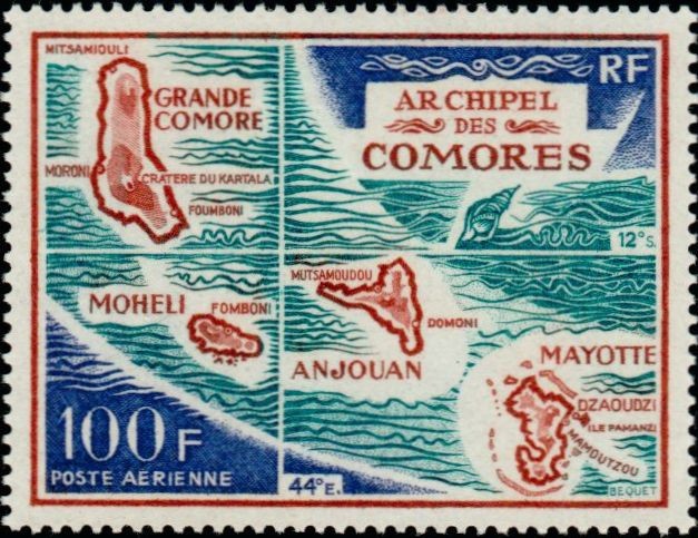
Map of the Comoro Archipelago
This high-value airmail (Poste Aérienne) issue serves as an administrative and geographical guide to the region, featuring a multi-paneled cartographic layout of the Archipel des Comores. The design splits the volcanic island chain into distinct quadrant maps, labeling each major landmass alongside its critical municipal and geological anchors: Grande Comore (highlighting Moroni, Mitsamiouli, Foumboni, and the Cratère du Kartala), Mohéli (noting Fomboni), Anjouan (marking Mutsamoudou and Domoni), and Mayotte (documenting Mamoudzou and the islet stronghold of Dzaoudzi on Île Pamanzi). Historically, this 1972 release documents the spatial and geopolitical identity of the territory just a few years prior to the historic 1974 independence referendum, utilizing detailed coordinates (44∘E. longitude and 12∘S. latitude) and local marine motifs like a stylized conch shell to broadcast the maritime boundaries of the islands.